
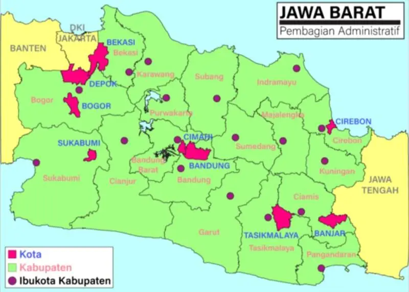
ZOAHARIAN.COM – A number of areas in West Java have a fairly high level of disaster risk. This condition is not only found in mountainous areas, but also coastal areas and urban areas with high levels of population density.
Based on InaRISK BNPB data, Sukabumi is recorded as the region with the highest disaster risk value in West Java, reaching 198.86.
Interestingly, Subang is in second place with a score of 165.51. This position places Subang as one of the areas that needs serious attention in mitigation efforts and disaster preparedness.
After Sukabumi and Subang, the areas with the next highest risk values are Tasikmalaya with 156.20, Karawang 147.42, and Cianjur 136.31.
List of Areas Most Prone to Disasters in West Java
The following is a list of regions in West Java based on available values:
Sukabumi: 198,86
Subang: 165,51
Tasikmalaya: 156.20
Karawang: 147.42
Cianjur: 136.31
Garut: 133,79
West Bandung: 124.45
Bogor: 122,64
Pangandaran: 118.18
Bandung: 112,32
Cirebon: 109,72
Bekasi: 105.45
Sumedang: 102,91
Purwakarta: 102.68
Banjar City: 100.80
Majalengka: 100.63
Brass: 93.66
Kota Cirebon: 93,31
Tasikmalaya City: 90.78
Ciamis: 85,52
Indramayu: 83,90
Bandung City: 76.47
Bekasi City: 67.79
Sukabumi City: 61.11
Depok City: 59.97
Cimahi City: 57.61
Bogor City: 54.59
The data shows that the five regions with the highest scores are Sukabumi, Subang, Tasikmalaya, Karawang and Cianjur.
Not Just Many Disasters
A high risk value does not merely indicate how often disasters occur in an area.
The risk assessment considers a number of components, especially the area'shazards, vulnerabilities andcapacities.
Hazards relate to the potential and characteristics of disaster threats. Meanwhile, vulnerability includes the social, economic, physical and environmental conditions of society.
Capacity describes the ability of the government and society to face, reduce and recover from the impacts of disasters.
The various threats taken into account can include earthquakes, floods, landslides, tsunamis, volcanic eruptions, extreme weather, drought, forest and land fires, to extreme waves and abrasion.
Why is Subang in Second Position?
Subang has quite a complex regional character. This area stretches from the southern region which has a mountainous character to the northern region which borders the coastal area.
Apart from agricultural and residential areas, Subang is also developing as an industrial area in West Java.
These differences in geographical characteristics mean that the potential for disaster threats in each Subang area is not always the same. Certain areas can face the threat of flooding and drought, while other areas have the potential for landslides, extreme weather or threats in coastal areas.
Therefore, people need to recognize the potential for disasters in their respective environments.
Simple steps can be taken by knowing evacuation routes, preparing emergency equipment, securing important documents, and following information from the government and official institutions when dangerous conditions occur.
On the other hand, local governments also need to strengthen mitigation through risk mapping, public education, building supporting infrastructure, and increasing preparedness for emergencies.
With a score of 165.51, Subang's position in second place is a reminder that disaster mitigation needs to continue to be strengthened. Moreover, the diverse character of the Subang region means that disaster management requires strategies that are adapted to the conditions of each region.
Comment (0)
No comments yet. Be the first!
Leave a Comment